Alaska’s glacial lakes are expanding, increasing the risk of destructive outburst floods
Published in Science & Technology News

Every summer, people living near the Mendenhall River in Juneau, Alaska, keep a close eye on the water level. When the river level begins to rise rapidly, it’s a sign that Suicide Basin, a small glacier-dammed lake 5 miles up the mountains, has broken through the glacier again and a glacial lake outburst flood is underway.
After nearly 15 straight years of ever-larger and more damaging floods in Alaska’s capital city, the U.S. Army Corps of Engineers is discussing an ambitious and expensive solution: create a permanent drain from the lake that would prevent it from reaching outburst stage.
The initial cost estimates for the project range from US$613 million to $1 billion.
Suicide Basin is just one example of a growing problem from glacial lakes that threaten communities around the world, particularly in the Himalayas and Andes, and is transforming Alaska’s landscape as global temperatures rise.
In a new study, colleagues and I documented the evolution of 140 of the largest glacial lakes in Alaska between 2018 and 2024. We found they are expanding about 120% faster on average today than they were from 1986 to 1999 – more than twice as fast.
Using ice thickness data to reconstruct the shape of the land beneath these glaciers, we found that these glacial lakes could become more than four times larger than they are today as the glaciers melt, increasing the potential for damage to downstream ecosystems and infrastructure from glacial lake outburst floods.
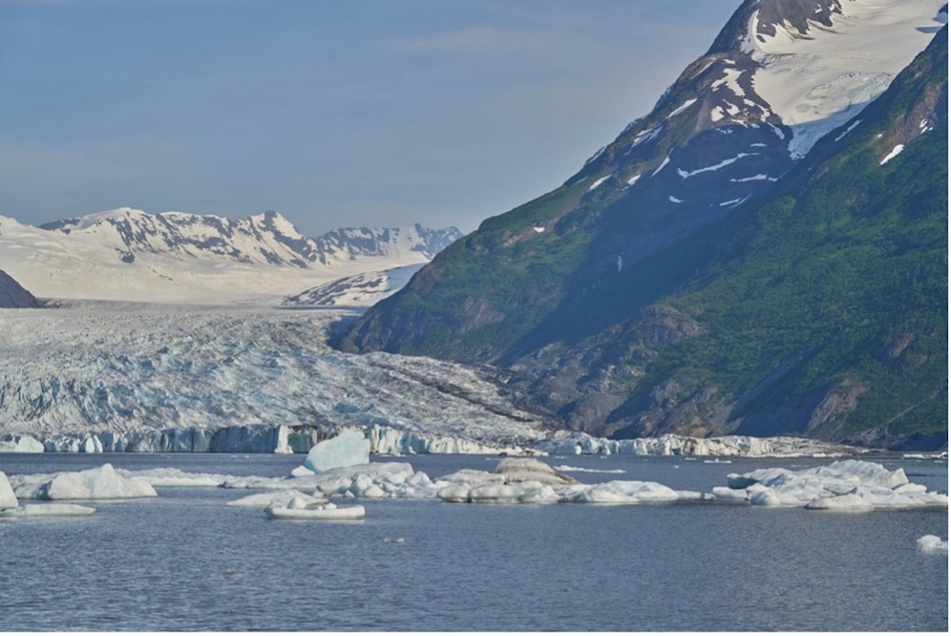
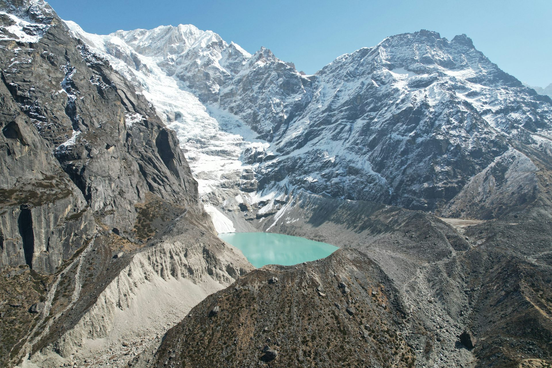
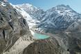
Glacial lakes, often the color of aquamarine gems and sparkling with icebergs, are common around the margins of glaciers around the world. Years of satellite images have documented a dramatic increase in their number, area and volume – a direct response to glaciers retreating as global temperatures rise.
Tenuously held back by moraines – the jumble of rock and sediment deposited by glaciers at their edges – or dammed by glacier ice, these lakes are anything but stable.
Between 1985 and 2020, ice-dammed lakes in Alaska alone broke through their barriers and drained more than 1,150 times. Alaska’s vast landscape and low population density means that the impact of these drainages on human infrastructure was fairly minimal, with a few notable exceptions, including Suicide Basin and Snow Lake, on the Kenai Peninsula.
However, the enormous amount of icy water rushing down rivers with each outburst can transform ecosystems, altering river channels through erosion and sediment deposition, tearing out trees and other vegetation, and damaging fish habitat.
A recent study found that glacial lake outburst floods from moraine-dammed lakes are occurring at an accelerating rate. In the steep, narrow valleys of the Himalayan Mountains, the impact of these events are acute: destroyed hydropower stations, roads and entire villages wiped away, taking hundreds of lives over the years.
More than 15 million people globally live in areas at risk of glacial lake outburst floods. Mapping where these lakes might form and expand can help people living downstream prepare. That’s what we did in Alaska.
Glacial lakes can form in a variety of settings: on the surface of glaciers, in side valleys, and at the terminus, or toe, of the glacier. We found that the fastest-growing lakes are those at the toe, and in our work, we showed that many of these lakes reside in deep depressions carved by glacial flow.
We mapped these depressions – known as glacial-bed overdeepenings – by subtracting ice thickness estimates from surface elevations measured by satellites.
We found that more than 80% of the lake growth has occurred in the mapped basins, illustrating how this approach can help locate glacial lakes that are likely to form and expand in the future.
With this information, we found that existing glacial lakes in the region may ultimately expand fourfold, growing by as much as 1,640 square miles (4,250 square kilometers). A glacial lake at the terminus of Malaspina Glacier, the largest glacier by area in southeast Alaska, could expand to cover an additional 570 square miles (1,475 square kilometers) alone. That would create what would be the second-largest lake in Alaska.
As glaciers continue to retreat, new basins will be exposed, many of which could fill with water. In total, more than 5,500 square miles (about 14,200 square kilometers) of overdeepened basins exist in Alaska, pointing to a landscape that is going to look very different in the coming decades to centuries.
When a glacier terminates in a lake, the warmth of the water can speed up the ice’s melting, making the glacier flow faster, thin and retreat, thereby expanding the size of the lake. We found that glaciers that terminate in lakes are shrinking 23% to 56% faster than land-terminating glaciers.
Future climate projections combined with sophisticated glacier models indicate that glaciers will cumulatively retreat by 26% to 41% by 2100, spelling the loss of 49% to 83% of all glaciers globally.
This is concerning for numerous reasons. Glacier mass loss is currently the largest contributor to sea-level rise. Melting glaciers also change the water quantity and timing of ice melt that feed major rivers, particularly Asian rivers such as the Indus and Ganges. And they create hazards, such as the outburst floods that originate from glacial lakes.
The landscapes that we know and love are transforming before our eyes, and with these changes come growing concerns about hazards.
This article is republished from The Conversation, a nonprofit, independent news organization bringing you facts and trustworthy analysis to help you make sense of our complex world. It was written by: Dan McGrath, Colorado State University
Read more:
As mountain glaciers melt, risk of catastrophic flash floods rises for millions
From record warming to rusting rivers, 2025 Arctic Report Card shows a region transforming faster than expected
Glacial lake outburst floods in Alaska and the Himalayas show evolving hazards in a warming world
Dan McGrath receives funding from the U.S. Geological Survey.


Comments