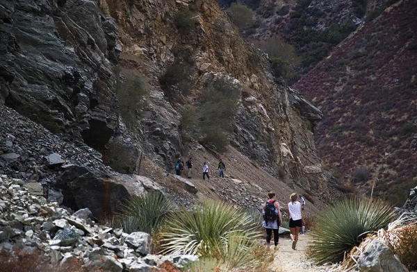
These 25 hiking trails were burned in the Bridge fire
Published in News & Features
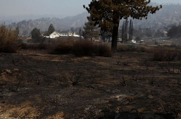


LOS ANGELES — As the Bridge fire spread from the East Fork of the San Gabriel River to the beloved mountain communities of Mount Baldy and Wrightwood last week, questions arose about what would be left in its wake. And those included which beloved hiking trails in the region were affected.
Now that the fire is 25% contained, an accounting of damage and trail closures has begun. Although firefighters saved local favorites such as Icehouse Canyon and the San Antonio Ski Hut in the Mt. Baldy area and the Mt. Baden-Powell hike near Wrightwood, several popular routes have been burned.
To put together a better picture of the damage, The Times consulted mapping tool CalTopo, cross-referencing its maps and the Bridge fire footprint with lists of local hiking trails to determine which routes were in the burn area. That said, just because a trail is in the burn area doesn't mean it was destroyed. We'll learn more about specific conditions of each trail in the coming weeks and months, as well as when trails might start to reopen.
In the coming days, officials are expected to release the U.S. Forest Service's first closure order outlining what parts of the burn area will remain closed. Just because a trail isn't on the list below doesn't mean it is open. If you're not sure about a particular location, it's best to call an Angeles National Forest office to speak with staff about the area you'd like to visit.
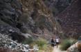
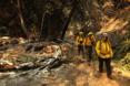
Below is a preliminary list of hiking areas that were burned in the Bridge fire.
East Fork and Camp Williams area
The Bridge fire was named after Cattle Canyon bridge in the East Fork of Angeles National Forest, where it started.
Although the fire got close, firefighters were able to save Camp Williams Cafe & General Store and Camp Williams Mobile Home Park from burning.
However, the hiking trails below appear to have been affected:
•The Bridge to Nowhere Trail (including the bridge itself)
•Cattle Canyon Trail
•Rattlesnake Peak Trail
•Rattlesnake Peak Loop
•Shoemaker Canyon Road
•Devil's Gulch Waterfall
•Iron Mountain viaHeaton Flat Trail
•Bonita Peak viaHeaton Flat Trail
•Heaton Saddle viaHeaton Flat Trail
•San Antonio Ridge: The first 10 miles, when starting in the East Fork area, is burned; the trail from near West Baldy onward is not burned.
•Allison Mine Loop
Mt. Baldy area
The mountain community of Mount Baldy isn't currently reachable because of road closures, but will be reachable once firefighters and forest officials survey and clean the area.
Popular hiking trails, including Icehouse Canyon and Icehouse Saddle appear, via the fire map, to not have burned in the Bridge fire. Additionally, San Antonio Falls, Ontario Peak, Cucamonga Peak, Cedar Glen Camp, and the three T's — Timber Mountain, Telegraph Peak and Thunder Mountain — also did not burn. Although the fire moved near Stoddard Peak's trailhead, its trail was spared.
Here is a list of some of the popular trails that appear to have burned, according to The Times' analysis:
•Old Mount Baldy Trail: The fire burned about 4.4 miles of the trail, starting near the trailhead, scorching almost half a mile of Bear Canyon Road and almost four miles of the Bear Canyon Trail
•Bear Flats viaBear Canyon Trail
•Lookout Mountain viaBear Canyon Trail
•Sunset Peak Trail
•Sunset Ridge Road
Wrightwood and Vincent Gap area
Although the fire got within about 500 feet of the Mt. Baden-Powell trail, it was not burned in the Bridge fire. Additionally, nearby mountains, including Mt. Burnham, Throop Peak and Mt. Hawkins, did not burn. The immediate area surrounding Jackson Lake was not burned, but multiple trails in that area did. The Grassy Hollow Visitor Center was destroyed.
•About 12 miles of thePacific Crest Trail: The trail is burned starting about half a mile northeast of Vincent Gap, past the Grassy Hollow Visitor Center and Inspiration Point, until the trail skirts past Wright Mountain.
•Pine Mountain viaAcorn Trail, Pacific Crest Trail andNorth Backbone Trail: the majority of the trail burned; the final 0.7 miles nearest Pine Mountain were spared.
•Big Horn Mine Trail: About the first half mile did not burn, but the rest of the trail did, including the mine.
•Boy Scout Trail loop
•Ross Mountain via Vincent Gap:The trail is not burned until about 1.75 miles north of the Mt. Baden-Powell summit, when the final 1.25 miles to Ross Mountain is burned.
•Pinyon Ridge Nature Trail:The first mile doesn't appear to have suffered damage, but later parts of the trail were burned, although not totally.
•Inspiration Point to Grassy Hollow
•Inspiration Point to Snowmaking Pond Loop, via the Pacific Crest Trail and Blue Ridge Truck Trail
•Inspiration Point to Guffy Campground
This list is based on preliminary data and will be updated, including once Angeles National Forest issues a closure order, outlining wh ich areas will remain closed after the Bridge f ire is contained.
©2024 Los Angeles Times. Visit at latimes.com. Distributed by Tribune Content Agency, LLC.


Comments